
FLAIR-HUB -- Crop-type mapping models (LPIS)
Collection
5 items
•
Updated
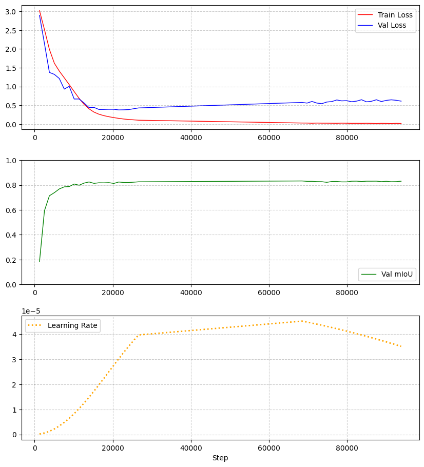
- Model architecture: swin_base_patch4_window12_384-upernet
- Optimizer: AdamW (betas=[0.9, 0.999], weight_decay=0.01)
- Learning rate: 5e-5
- Scheduler: one_cycle_lr (warmup_fraction=0.2)
- Epochs: 150
- Batch size: 5
- Seed: 2025
- Early stopping: patience 20, monitor val_miou (mode=max)
- Class weights:
    - default: 1.0
    - masked classes: [clear cut, ligneous, mixed, other] → weight = 0
- Input channels:
    - AERIAL_RGBI: [4, 1, 2]
    - SPOT_RGBI: [4, 1, 2]
    - SENTINEL2_TS: [1, 2, 3, 4, 5, 6, 7, 8, 9, 10]
    - SENTINEL1-ASC_TS: [1, 2]
    - SENTINEL1-DESC_TS: [1, 2]
- Input normalization (custom):
    - AERIAL_RGBI:
        mean: [106.59, 105.66, 111.35]
        std:  [39.78, 52.23, 45.62]
    - SPOT_RGBI:
        mean: [1137.03, 433.26, 508.75]
        std:  [543.11, 312.76, 284.61]
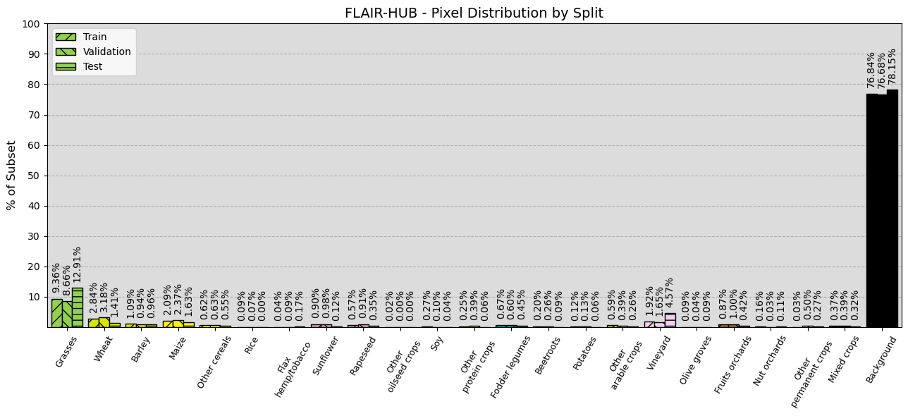
- Train patches: 152225
- Validation patches: 38175
- Test patches: 50700
| Metric | Value |
|---|---|
| mIoU | 32.35% |
| Overall Accuracy | 87.97% |
| F-score | 43.04% |
| Precision | 50.96% |
| Recall | 42.60% |
| Class | IoU (%) | F-score (%) | Precision (%) | Recall (%) |
|---|---|---|---|---|
| grasses | 52.02 | 68.44 | 73.20 | 64.26 |
| wheat | 57.45 | 72.97 | 64.92 | 83.30 |
| barley | 30.96 | 47.29 | 72.74 | 35.03 |
| maize | 78.30 | 87.83 | 84.77 | 91.11 |
| other cereals | 8.15 | 15.08 | 18.59 | 12.69 |
| rice | 0.00 | 0.00 | 0.00 | 0.00 |
| flax/hemp/tobacco | 10.61 | 19.19 | 88.66 | 10.76 |
| sunflower | 45.82 | 62.85 | 53.61 | 75.92 |
| rapeseed | 71.89 | 83.64 | 82.53 | 84.78 |
| other oilseed crops | 0.00 | 0.00 | 0.00 | 0.00 |
| soy | 33.68 | 50.38 | 62.54 | 42.19 |
| other protein crops | 8.93 | 16.39 | 18.95 | 14.44 |
| fodder legumes | 27.19 | 42.76 | 44.10 | 41.50 |
| beetroots | 75.31 | 85.91 | 84.14 | 87.77 |
| potatoes | 14.37 | 25.13 | 19.45 | 35.48 |
| other arable crops | 22.10 | 36.20 | 39.78 | 33.22 |
| vineyard | 44.55 | 61.64 | 56.82 | 67.36 |
| olive groves | 16.38 | 28.14 | 55.59 | 18.84 |
| fruits orchards | 36.57 | 53.55 | 47.56 | 61.27 |
| nut orchards | 6.60 | 12.38 | 19.69 | 9.03 |
| other permanent crops | 12.12 | 21.62 | 84.16 | 12.40 |
| mixed crops | 2.30 | 4.50 | 7.39 | 3.24 |
| background | 88.73 | 94.03 | 92.86 | 95.22 |
Aerial ROI
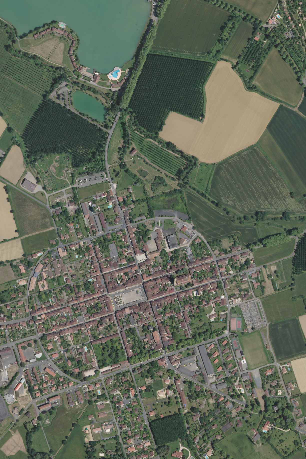
Inference ROI

BibTeX:
@article{ign2025flairhub,
  doi = {10.48550/arXiv.2506.07080},
  url = {https://arxiv.org/abs/2506.07080},
  author = {Garioud, Anatol and Giordano, Sébastien and David, Nicolas and Gonthier, Nicolas},
  title = {FLAIR-HUB: Large-scale Multimodal Dataset for Land Cover and Crop Mapping},
  publisher = {arXiv},
  year = {2025}
}
APA:
Anatol Garioud, Sébastien Giordano, Nicolas David, Nicolas Gonthier.
FLAIR-HUB: Large-scale Multimodal Dataset for Land Cover and Crop Mapping. (2025).
DOI: https://doi.org/10.48550/arXiv.2506.07080